Situated on picturesque Casco Bay, Portland is home to many waterfront treasures. The city’s bustling Old Port features a waterfront that serves fishing fleets, industry, a Coast Guard station, and tourists. Across the city, trails and parks ring the quieter Back Cove coastline.
Encroaching Tides
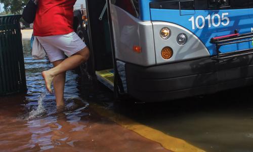
With much of its commerce and infrastructure concentrated close to the water, the city is vulnerable to flooding during high tide, even in fair weather. When floods occur, pedestrian pathways and piers can become unusable, and businesses struggle to stay open.
Today Portland sees about a dozen tidal floods each year, but it is projected to face more than 60 annually by 2045. About eight inches of sea level rise by 2050 could increase the cost of damage to real estate from all forms of coastal flooding in the Back Cove area alone by about $90 million if no action is taken. Drawing on a suite of scientific and economic simulations, the city is beginning to consider its options for adapting to rising seas, including installing surge barriers or levees.
Related resources

Sea level rise, explained by kids

Science Hub for Climate Litigation

Research Areas for Climate Litigation