Encroaching Tides
Lewes is a small town that prides itself on its strong relationship with the sea. With its walkable downtown, active recreational fishing industry, and five-mile-long beachfront, Lewes offers visitors and year-round residents alike an intimate seaside experience.
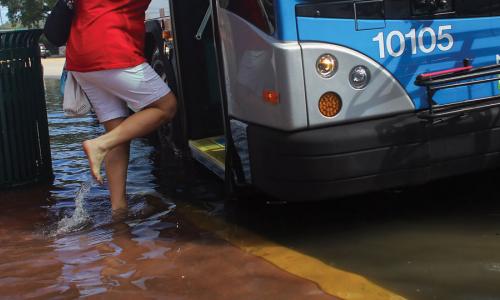
Owing to its mid-Atlantic location, however, Lewes sees flooding during both nor’easters and tropical storms. Extra-high tides occurring even without storms can also affect roadways and cause erosion in downtown Lewes and nearby beach communities.
Because of sea level rise, Lewes is projected to face almost 90 tidal floods a year in 15 years. By 2045, the city could see more than 200 tidal floods annually—nearly 30 of them more extensive than those of today.
By developing the first-ever community action plan that integrates hazard mitigation and adaptation to climate change, Lewes has been a small-town leader in the mid-Atlantic region in planning for sea level rise. The University of Delaware and the Delaware Geological Survey also recently completed a Coastal Flood Monitoring System, which will communicate information in real time to residents, emergency managers and first responders, and others so they can prepare for flood events.
Related resources

Sea level rise, explained by kids

Science Hub for Climate Litigation

Research Areas for Climate Litigation