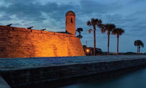
This profile is excerpted from the 2014 report, National Landmarks at Risk: How Rising Seas, Floods, and Wildfires Are Threatening the United States' Most Cherished Historic Sites."
Rising seas and heavier rainfall are threatening an iconic place—Fort Monroe, VA—in the centuries-old struggle for liberty and justice in the United States.
This imposing fort, perched on low-lying Old Point Comfort at the mouth of Chesapeake Bay, played a pivotal role in bringing an end to slavery on the very spot that also had witnessed slavery’s beginning. President Obama recognized Fort Monroe’s extraordinary history when he designated the site a national monument in 2011.
But now the Virginia fort that served as a beacon of freedom to escaping slaves needs protection itself—from rising water levels and increasingly severe flood damage caused by climate change.
On the night of May 23, 1861, just hours after the ratification of Virginia’s secession from the Union, three young enslaved people—Sheppard Mallory, Frank Baker, and James Townsend—rowed across the waters of Hampton Roads to Union-held Fort Monroe in search of freedom. The three men had escaped from a work detail that was building Confederate defenses at nearby Sewell’s Point. Soon afterward, when a Confederate officer arrived to demand the return of the fugitives, Fort Monroe’s newly arrived commander, General Benjamin Franklin Butler, made a decision that would eventually lead to President Abraham Lincoln’s Emancipation Proclamation. He refused to return the men, on the basis that they were “contraband of war.”
Word of the “contraband” decision spread quickly across the slave states, and soon a flood of escapees began flocking toward Union camps and forts, all seeking liberty. Many volunteered to help the Union cause as soldiers, scouts, and laborers. The courage of these men, women, and children led Congress to pass a series of laws that guaranteed their freedom—and that cleared a path for the president to issue his Emancipation Proclamation.
As space in and around Fort Monroe began running out, Great Contraband Camp, one of the first self-contained African-American communities in the country, sprang up in the burned-out ruins of Hampton. In 1861, a free black woman, Mary Peake, began teaching classes in the shade of a spreading oak tree, where in 1863 the first Southern reading of the Emancipation Proclamation would be heard. Peake’s makeshift schoolroom evolved into Hampton University, one of the nation’s first historically black colleges. Today, the Emancipation Oak still stands on the campus, a symbol of the promise of education for all.
Fort Monroe was also the setting of an earlier chapter in the history of slavery. In 1609, soon after the English settlers first arrived at Jamestown, they built a defensive outpost at Old Point Comfort, the site of Fort Monroe, and it was here that in 1619 the first African slaves to arrive in English North America made landfall. Thus across the span of some 250 years, this small spit of land witnessed both the beginning and the end of slavery.
Fort Monroe is highly vulnerable to sea level rise and coastal flooding. A nearby tide gauge shows that water levels near the fort have risen almost a foot and a half since the 1920s. A study for the Virginia General Assembly projects the state’s coastal waters could rise as much as another two feet by 2050 and up to six feet by the end the century. With a higher sea level, coastal storm surges—the potentially destructive increases in sea height that occur during a coastal storm—could inundate areas much farther inland. In addition to the rising sea, since 1950 the area around Fort Monroe has also experienced significantly more heavy-rainfall events than before.
The combination of rising sea levels and heavier precipitation will likely increase the frequency and severity of flooding at Fort Monroe. The tide gauge at Sewells Point measured storm surges of more than four and a half feet during Hurricane Irene in 2011 and over five and a half feet during Hurricane Isabel in 2003. Hurricane Isabel caused more than $100 million in damage at Fort Monroe, with nearly 200 housing units and administrative buildings damaged by floodwaters and several wooden piers destroyed.
After Isabel, the Army Corps of Engineers built a new seawall, but in so doing it took into account only the historic rates of sea level rise, not the higher rates that Hampton Roads is likely to experience from now on.
Already, flooding events triggered by storms and exceptionally high tides regularly inundate basements and cause untreated sewage to flow directly into Chesapeake Bay. One recent study found that among the highest tides recorded at Sewells Point between 1930 and 2010, half of them occurred in the last 13 years of the study period.


